Needham History: Village Falls Park
Beneath the dark water along the riverbank,
the old turbine and buckets lie quietly.
The Village Falls Park
Charles River Village – I think the residents of that part of town may still use the term, but for most of us it doesn’t ring a bell. (That was a very obscure pun*). Charles River Village is the section of town at the end of Central Avenue beyond Pine Street – Charles River Street, South Street, Wilson Lane, Fisher Street, Walker Lane, etc. It has always been part of Needham, but it had its own local identity. Because it was so remote from the rest of town, it had its own Post Office and General Store, its own train station (now part of the rail trail), its own school, and its own fire alarm/school bell (*bingo!) But all of these are stories for another time.
Although Charles River Village was mostly farmland, it was also a small outpost of industry. At the very southern end of South Street, just before you cross Newell’s Bridge into Dover, is a small DCR park called Village Falls, but known to the locals as Cochrane’s Dam. The park is a broad sloping lawn that leads down to the Charles River; in the river is a small artificial falls that tells of centuries of manufacturing on that site.
The Charles has always been a challenge to use as a source of mill power because it is so sluggish. If you look over the other side of Newell’s Bridge, you see a widening in the river known as Red Wing Bay, so stagnant that it often looks more like a lake than a river. The solution for generating water speed – at Cochrane’s Dam, as well as at the Upper and Lower Falls – was to enhance a natural falls or slope by adding a mill dam to increase its height.
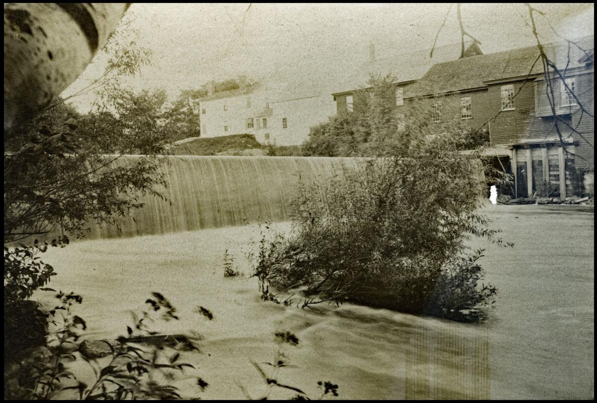
The original mill dam on this site was built in 1675 by Joshua and Daniel Fisher, whose land lay along that section of the river. It is not known how they used this early dam, but by 1755 the Fisher family had built a grist mill on the site. The grist mill was where grain was ground into flour, and was an essential part of any farming village. The grindstones were powered by a water wheel that was turned by the river currents. The miller received a portion of the milled flour as the fee for his service. This site shows up as “Fisher’s Mill” on the 1771 Barachaiah Mason map of Needham, which is the earliest extant map of the town. There was also a grist mill in Lower Falls.
The grist mill lasted into the 1770s or later, but in 1795 the mill became a paper mill belonging to George Bird. George Bird was born in Maine, and apprenticed at a paper mill in Milton, MA. When ready to go into business for himself, he moved to Needham and converted the grist mill to make both fine paper and newsprint. In 1803 he moved his business to Dedham to make banknote paper under government contract. His descendants moved the company to Walpole, where it lived on as Bird & Sons (Bird Machine Co.), making variety of machinery, building products, and papers until it was sold off and closed in 2004.
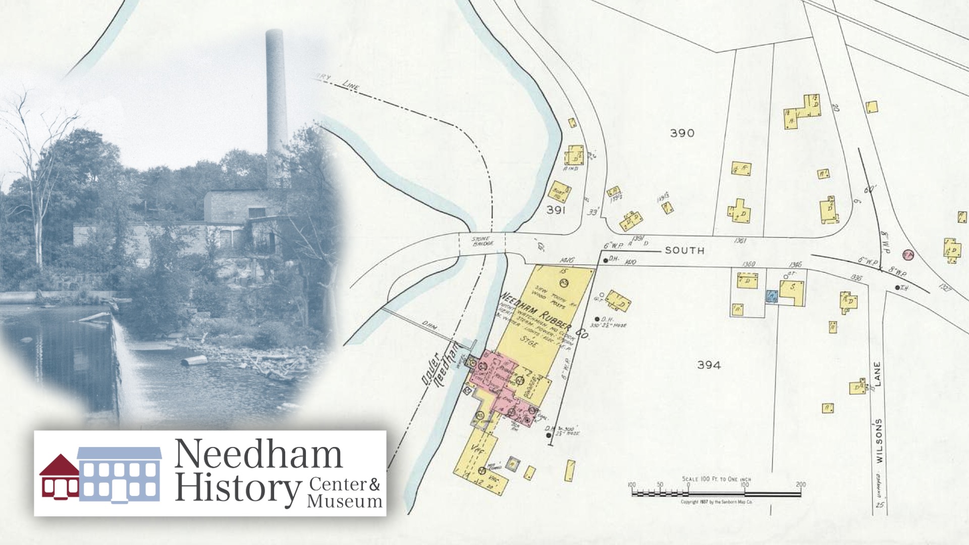
The abandoned Charles River Textile Company in 1964. This mill and chimney were built after the fire in 1893, and also housed a rubber company and a bleaching mill. They were demolished in 1973 to form the current park.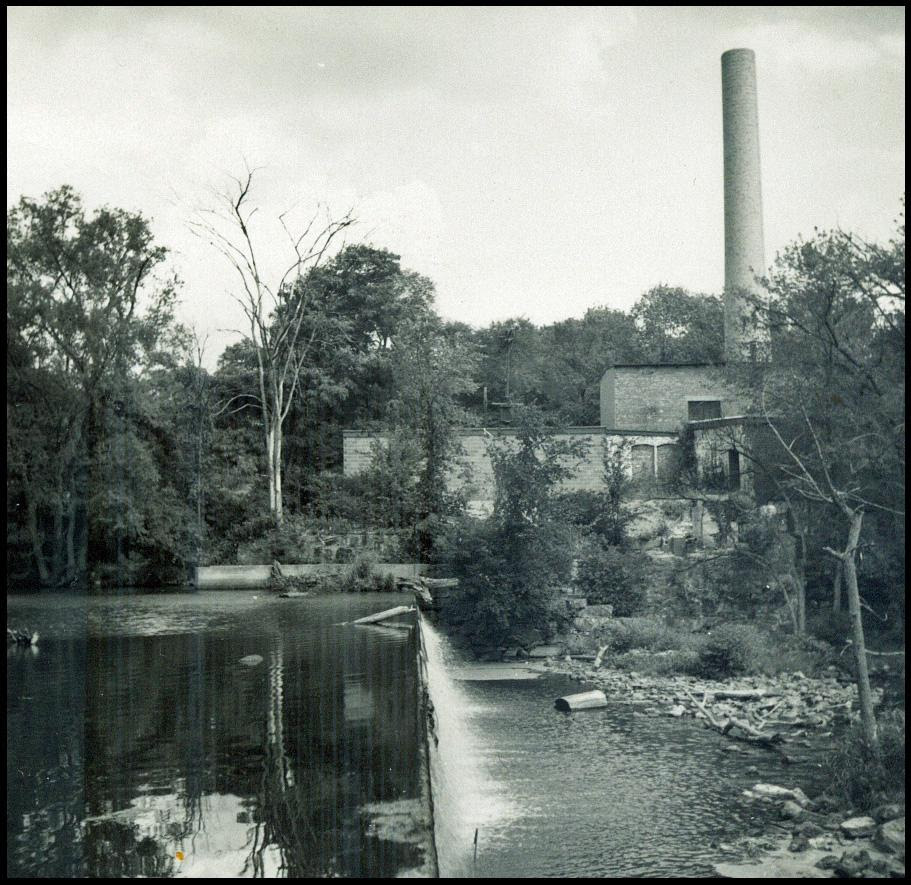
The mill continued on as a paper mill under various owners until 1862. It was expanded and new machinery installed by proprietors Goss & Russell in 1853. It appears on the 1856 Henry Walling map of Needham as the Goss & Russell Paper Mill. From 1803 to 1862, the mill mostly manufactured coarse brown paper used for wrapping. During this period, around 1828, the old dam was in poor condition and had to be rebuilt.
In 1862, William Ward bought the mill and turned it into a shoddy mill. “Shoddy” was a type of low-grade textile made by shredding and reusing the fibers from other discarded textiles. During the Civil War, shoddy was often (and improperly) used to make Union uniforms. Vendors were supposed to supply the government with higher-quality textiles, but often got away with selling shoddy for the higher price. The uniforms wore out and tore easily, and so the use of the term “shoddy” to mean “cheaply and badly made” dates to the Civil War.
The shoddy mill burned down in the 1870s, and was rebuilt as a paper mill, with more modern equipment for making better-quality papers. It continued as a paper mill under several owners until 1893, when it again burned to the ground.
Over the next 50 years, the rebuilt mill would serve a number of industries. From 1917 to 1922, the Needham Tire Company employed 100 people to make overshoes and shoe heels from reclaimed rubber tires. In the 1920s, it was the site of the Charles River Bleaching & Print Works, owned by J. Eugene Cochrane & Sons – and this is the name that stuck. Its last owner was the Charles River Textile Company, which made woolen “nubs and slugs” – the tiny balls of wool that give tweed its texture (who knew?). By 1950, the mill was no longer in use, and was deteriorating through a combination of abandonment and vandalism. At this point the neighborhood stepped in. The Village had become more populous and residential over its many years, and the Charles River Village Neighborhood Association was formed to protect the neighborhood from further industrialization.
The site languished for nearly twenty years, until a new owner purchased it with the aim of rezoning for a condominium development. The town rejected the rezoning request, and also a subsequent request to use the site as an office park. The Metropolitan District Commission (now the MA Dept. of Conservation and Recreation) stepped in (possibly with the encouragement of the Needham Conservation Commission) to purchase the property and establish a public park. The buildings were demolished in 1972 and 1973, and the site cleared and graded to make the Village Falls Park. The old dam was repaired again in 1997 to form part of the river’s flood-management system.
Water over the dam is such a routine sight that it can be quite startling when it stops flowing. Two years ago, in August 2022, the Charles River at the dam site reached the lowest level ever recorded – 0.4 feet. The river literally ran dry, and for the first time in at least 30 years (maybe many more) the old 1828 structure was visible. We are currently in drought again, with the river only measuring about 0.5 to 0.7 feet. Only last summer, and again last winter, however, the river was in flood, reaching nearly 7 feet and inundation the surrounding land for some months.
The dam site is now quiet, except for the sounds of the river and the birds that congregate along its banks. The debris was carted away, and the site leveled; the mown grass is interspersed with native plants allowed to grow wild, and a few benches on which to sit and enjoy its peace. After almost 300 years of industry, the dam is the only visible evidence of all those years of production and innovation. Though I’m told that, beneath the dark water along the riverbank, the old turbine and buckets lie quietly as reminders of this industrious time.
(*That bell was given to the Historical Society in 1949, and sat in the front yard of the Glendoon House for many years. Two years ago, we loaned it to the Needham Fire Department to install as an exhibit in the new Heights Fire Station.)
In August 2022, the Charles River fell to its lowest recorded level – 0.4 feet. For the first time in decades, the dam itself was visible, showing the 1828 structure with the 1970s capstone repairs.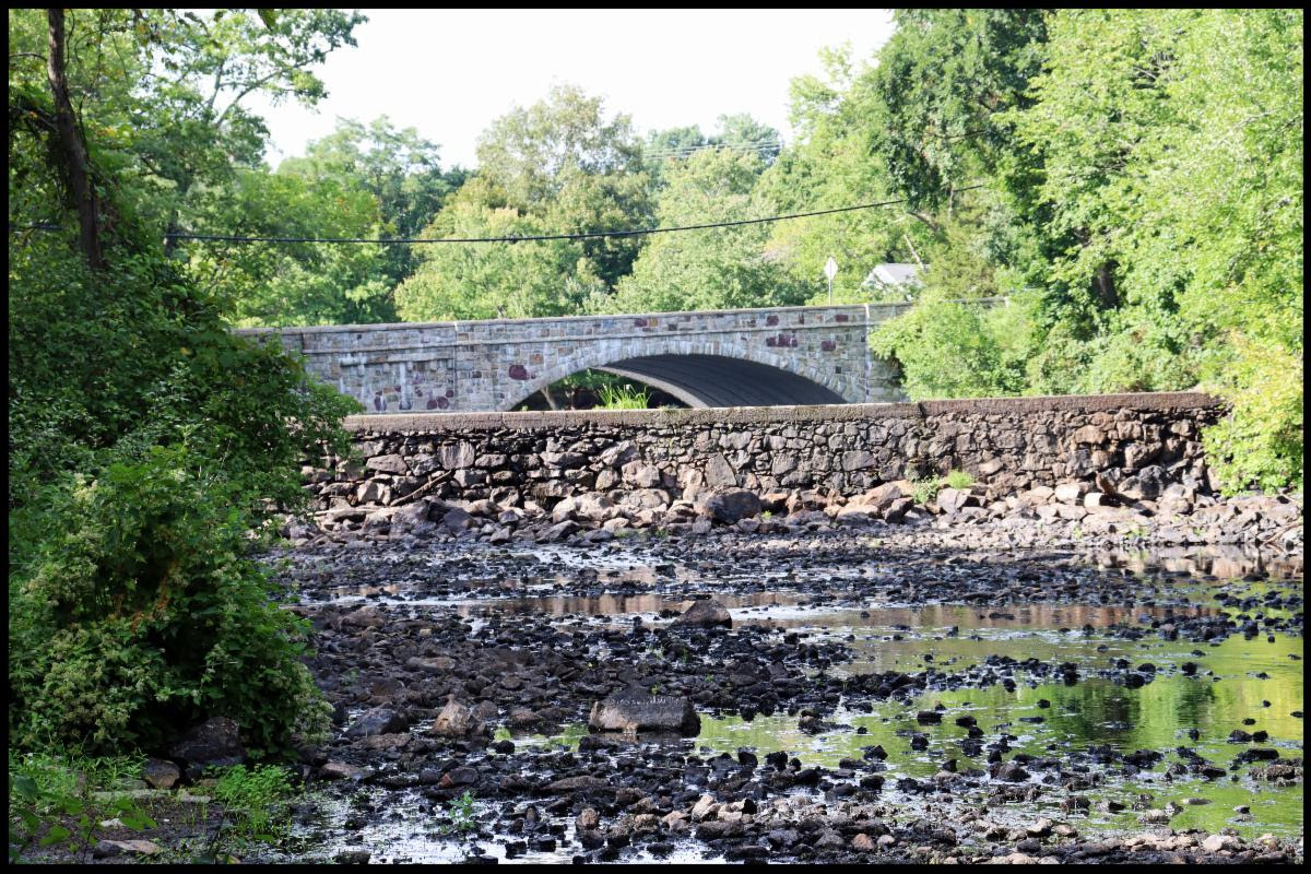
 |
Gloria Polizzotti Greis is the Executive Director of the Needham History Center & Museum. For more information, please see their website at www.needhamhistory.org. |

