Needham History: The First Big Dig
Mind the trails, and wear your boots.
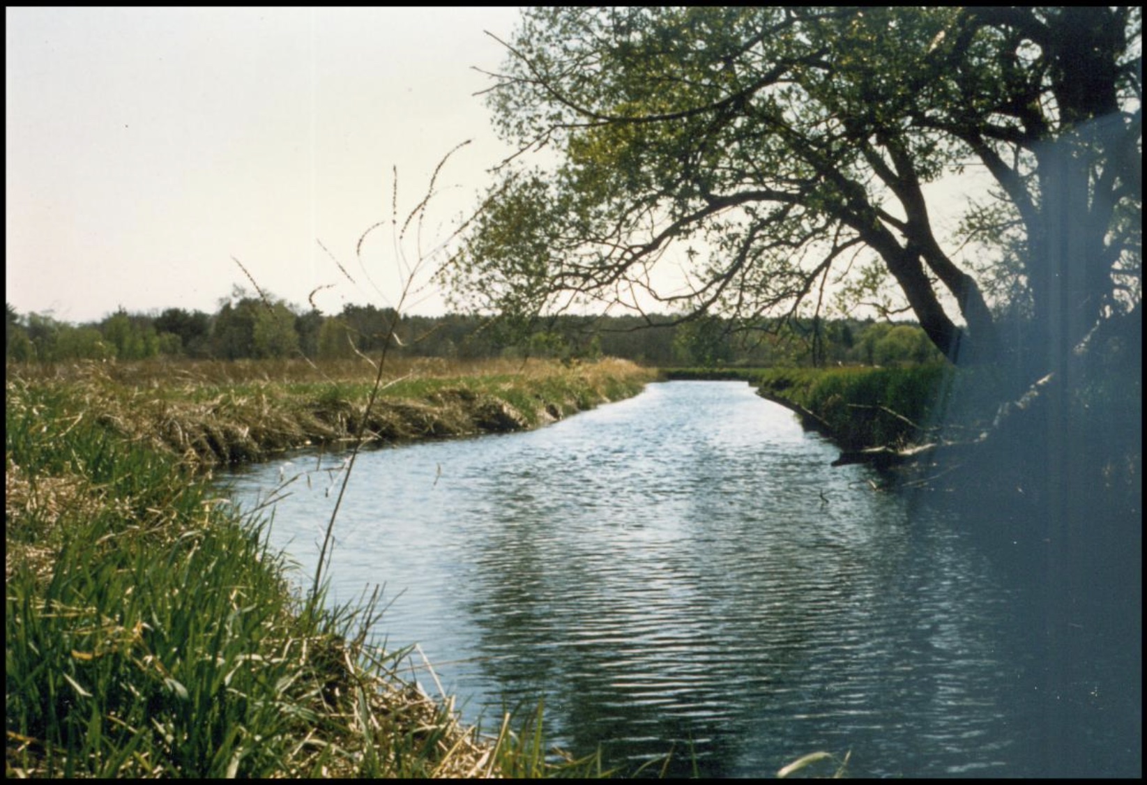
The Great Ditch through the Broad Meadows, 1960s.
The First Big Dig
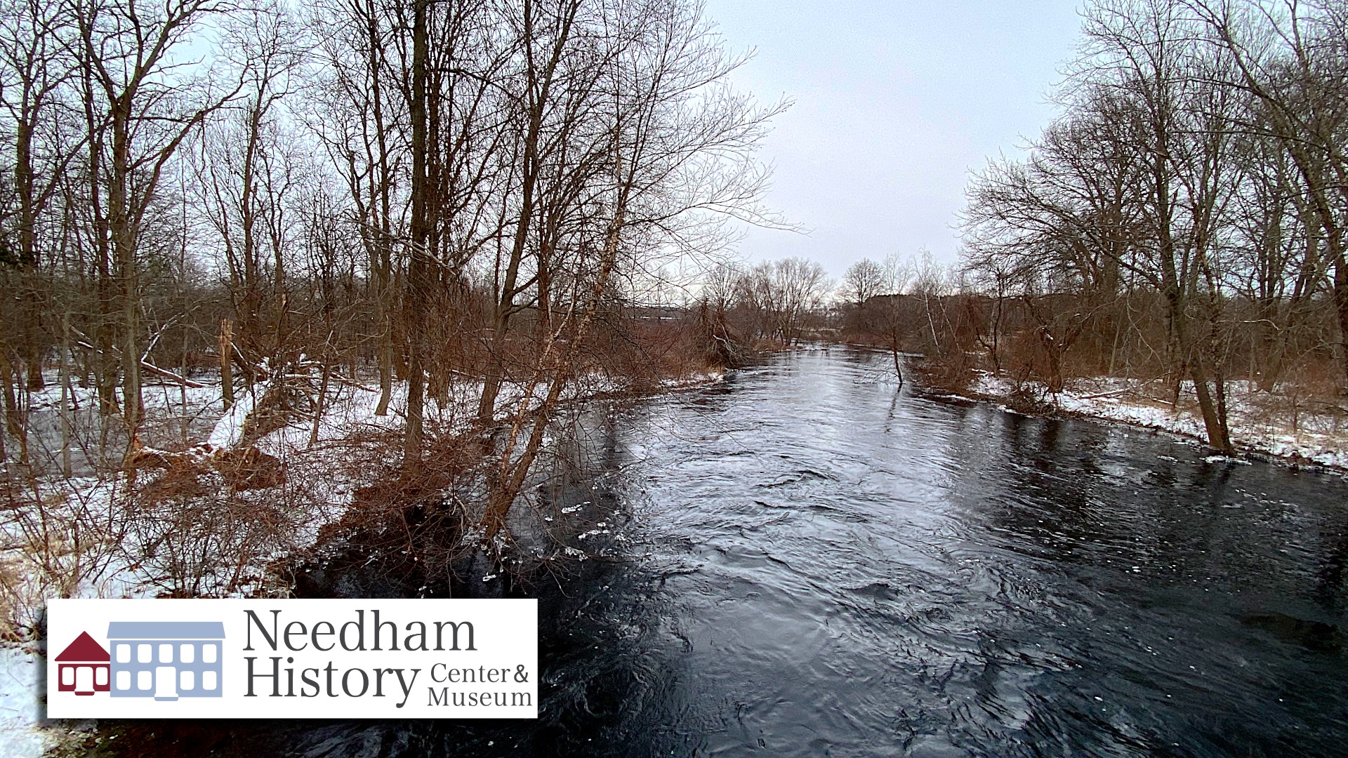
My favorite gauge in the Charles River at the Dover line confirms that the Charles is once again in flood stage. This is the second time in a month that the river has approached the 7-foot major flood mark, reaching 6.86 feet on December 22 and 6.77 feet on January 15. Not that we really needed the stats, because any casual pass near the river shows that the water is well above its banks.
In his newsletter this week, Greg Reibman, President of the Charles River Chamber, notes that some of this flooding is intentional – or, at least, more under control than it looks. You may have noticed the narrow little bridge beside the Charles River where Great Plain Avenue crosses into Dedham. Harder to notice is that the bridge is there to cross a small culvert over an ancient canal. This canal, once known as the Great Ditch or the Long Ditch, is one of the oldest canals in the country, dating back to the 1650s. It was dug to help control the flooding and drainage along that low-lying and marshy stretch of river. In the 1970s, the Army Corps of Engineers assessed this situation, and decided that their best bet was to leave well alone, so they purchased nearly 8000 acres along the river between Watertown and Rt 495 to serve as a containment area for the overflow. Greg cites an article from Universal Hub with the details, which you can read HERE.
One of the great attractions of this area for English settlement in the 1600s was the expanse of the Broad Meadows, which provided excellent grazing land. The Broad Meadows is all of that marshland that now runs alongside Route 128 and the train line toward Dedham and West Roxbury, filled with marsh grasses and cattails, and bright with invasive-yet-beautiful purple loosestrife in the summer. The Meadows were desirable because the marshy ground did not support the thick forest cover that flourished on firmer ground, so it could be used without the back-breaking work of clearing the trees. Also, the abundance of water was necessary for always-thirsty cattle, which were the primary livestock here.
However, the Charles River was always subject to seasonal floods and sometimes the water was too abundant, spilling over roads and farmland. The solution was to cross the meadows with dikes and drainage channels to drain off the excess water into the Charles and Neponset Rivers. The English who settled this area were from East Anglia, the low- lying and marshy southeastern counties, and were well-acquainted with this kind of drain building. The English Fens were subject to severe seasonal floods, and the English had learned about digging drainage canals centuries before from the Dutch.
The first canal in the area was the Mother Brook in Dedham, which still runs from the Charles River near the Dedham Mall to the Neponset River in Hyde Park, a distance of about 3.6 miles. It was begun in the summer of 1639 and about 16 months to complete. With an overall drop of about 45 feet, flow through the channel was also strong enough to power the water wheels of several small mills. The Mother Brook is often described as the first canal dug by the English in the colonies, but this might not be entirely accurate – there was a canal proposed for Cambridge in 1631, though it is not clear that this was ever built; and a short bypass/canal was dug on the Cape in 1634 to provide a passage between towns that was safer than the open coastal route. Either way, it is certainly the first significant canal, and the first used for commerce.
Needham’s Great Ditch was constructed in 1652; it helped to drain the Broad Meadows, and also to facilitate traffic along the Charles River. The Ditch cuts across a long looping section of the river, shortening the slow journey toward Upper Falls by several miles. Roads were few and bad in the 1600s, so most goods traveled by river. There was no additional industry along the Great Ditch, because the level was mostly even along its length.
The Great Ditch is about three-quarters of a mile long; it is currently 16 feet wide and three feet deep. It was dug with shovels and knives, hacking through the thick, matted vegetation of the marsh. It was started from the two ends, working toward the middle, and there is a bend in the center where the two paths had to be aligned. Not mentioned in the records is that the Ditch was the main drain in a network of drains throughout the Broad Meadows. Aerial views of the Meadows show this network as a tracery of dark lines across the lighter green/yellow of the marsh. Most of these smaller channels have filled up with silt over the centuries; but a few, and the Great Ditch itself, are still open and flowing, even after nearly 400 years.
When Needham separated from Dedham in 1711, Great Plain Avenue (at that time, “The Causeway”) was the main route between the two towns. The Charles River was established as the new boundary, except for the area near the Causeway. Needham claimed that the Ditch formed the boundary, but Dedham claimed the Ditch for itself and set the boundary about a quarter-mile east, just after what is now Exit 33 (Rt. 128). This dispute went on for many years. There was said to be a boundary marker stone, with N (Needham) on one side and D on the other, just by the Ditch, proving Needham’s claim. However, modern maps (and the “Welcome to Dedham” sign) show the current boundary to be where Dedham claimed it.
The Great Ditch is accessible for hiking, fishing and canoeing. There are small parking areas near the bridge on both sides of the road to enter the property, which is public. There are signboards on the northern (from-Dedham) side showing the layout of the canal and trails. But it’s still a marsh, so mind the trails, and wear your boots.
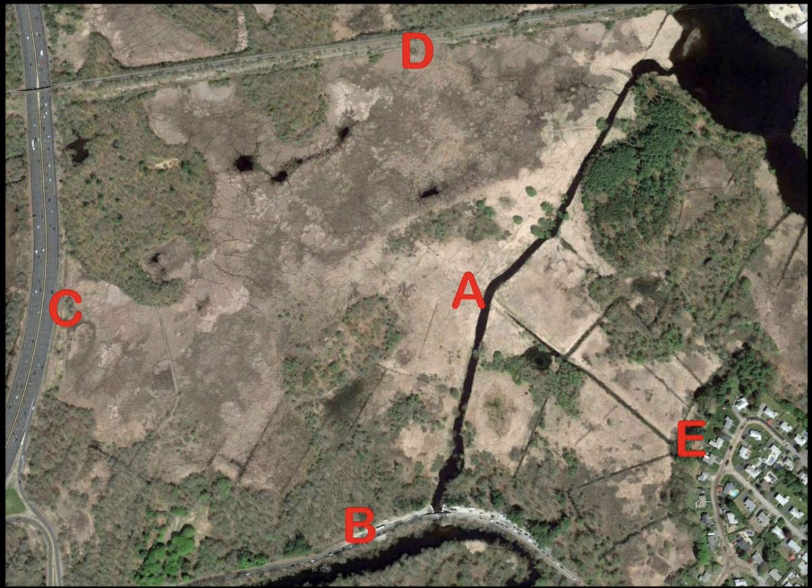
Aerial view of the Great Ditch (Google Earth), showing the Ditch (A), Great Plain Avenue (B), Route 128 (C), the train tracks headed toward West Roxbury (D), and Rosemary Road in Dedham (E). Additional drainage channels are still visible north of Great Plain Avenue (between B and C), and east of the main Ditch (between A and E).
| Gloria Polizzotti Greis is the Executive Director of the Needham History Center & Museum. For more information, please see their website at www.needhamhistory.org. |